The Water Retention Index: Using land use planning to manage water resources in Europe
Sustainable Development
About
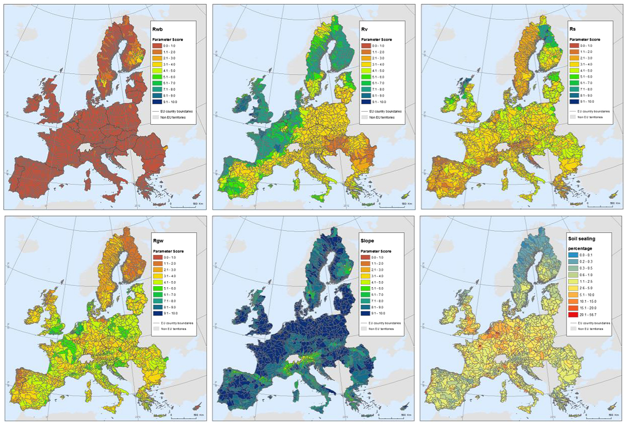
Appropriate land management can be an effective approach to improving water quantity regulation. There is, however, a need to identify both where measures are most needed and where they may be most effective. The water retention index (WRI) was developed with this goal in mind. The WRI is a composite indicator which takes into account parameters reflecting potential water retention in vegetation, water bodies, soil and underlying aquifers, as well as the influence of slope and artificially sealed areas. Three land management scenarios were simulated up to 2030 using the LUISA modeling platform: increasing grassland in upstream areas as well as afforestation in both upstream areas and riparian zones. The WRI was computed for all scenarios as well as a comparative “business-as-usual” baseline scenario. All scenarios showed an overall improvement of the index as compared to this baseline, with afforestation in upstream areas having the greatest effect. The WRI can provide useful insights into the current capacity of a landscape to regulate water as well as the effectiveness of possible remediation strategies applied at the European scale.